
Carrickleck Hill [Carraig Leice]
Good walks are even better shared.
Overview
Carrickleck Hill [Carraig Leice]
Overview
Carrickleck Hill is a delightful gem nestled in the picturesque Sperrin Mountains of Northern Ireland. Standing at 410 meters, it may not be the tallest peak in the region, but its charm lies in its stunning views and approachable trails that make it perfect for hikers of all levels.
Geology
The hill is primarily composed of granite, which provides a stark contrast to the rolling green hills surrounding it. The unique geological features create diverse habitats, supporting a rich array of flora and fauna.
Hiking Routes
The main route to the summit is the Sperrin Mountain Trail, a well-established circular walk that spans approximately 8.5 km. This route takes you through a mix of grassy paths and rocky outcrops. Expect to spend around three hours enjoying the journey and taking in the breathtaking scenery.
Summit Features
Once you reach the summit, you'll find a modest yet charming stone cairn. It's an excellent spot for a well-deserved break and some photos. It's like the mountain's way of saying, 'Well done, you made it!'
Terrain Type
The terrain varies from grassy to rocky, and can be a bit boggy in places, especially after rain. Good hiking boots are essential to tackle this beautiful hill without slipping or getting bogged down.
Views
The view from the summit is absolutely stunning! On a clear day, you can see the shimmering waters of Lough Neagh and the distant peaks of the Mourne Mountains. The best times to enjoy these views are during spring and autumn when the landscape is bursting with colour, but summer mornings can also reward you with clear visibility and fewer insects.
Hazards
Like any mountain, Carrickleck Hill does have its hazards. Weather changes can be sudden, so it’s wise to check the forecast before you begin your hike and always be prepared for changing conditions.
Nearby Summits
Nearby summits such as Sawel Mountain (674 meters) and Mullaghaneany (665 meters) are waiting to be explored, offering additional challenges for those keen on extending their hiking adventures.
Access
Parking is plentiful at the base of the Sperrin Mountains, conveniently located off the B47 road. If you're opting for public transport, there are bus services to Draperstown, which is about 10 km away from the trailhead. The nearest town, Draperstown, is charming and has everything a hiker might need.
Facilities
Cafés and shops in Draperstown provide a perfect pit stop for refreshments either before or after your hike. Plus, you'll find public toilets in the village, so no need to worry about that.
History
The name Carrickleck Hill, or 'Carraig Leice', means 'rocky hillock' in Gaelic, aptly reflecting its geography. The Sperrin Mountains are steeped in local folklore and history, making this hill not just a physical journey but also a cultural exploration.
In summary, Carrickleck Hill offers a delightful hiking experience, rich in natural beauty and history. Whether you're looking for a gentle stroll or a more vigorous outing, this hill will greet you with open arms – as long as you bring a packed lunch, of course!
Enjoy your adventure!
Explore routes near Carrickleck Hill [Carraig Leice]
Public walks starting within 80 km of this hill. Nearby does not mean a route reaches the summit; check its map and access before setting out.
Silent Valley to Ben Crom Dam: Reservoir Road Walk, County Down
View route
Scarva to Poyntzpass: Newry Canal and Lough Shark Return
View route
Portadown to Knock Bridge: Bann Boulevard and Moneypenny’s Lock
View route
Tollymore Forest Park: Mountain and Drinns Trail
View route
Route planning notes
These notes describe possible approaches, not verified navigable routes or permission to cross land. Check current paths, local access rules and conditions before setting out.
Sperrin Mountain Trail
A well-marked, circular trail that takes you through scenic glades and rocky outcrops, perfect for a half-day hike.
Make a day of it, together
Find someone to share the walk with, or organise a day out along a route you like.
Hill facts and local notes
Classifications
Elevation
173m
568 ft
Prominence
115m
Coordinates
53.8683, -6.7466
N825917
OS Map
35
At the Summit
The summit features a small cairn, offering a perfect spot for a selfie with the panoramic views in the background.
Terrain & Geology
Carrickleck Hill is primarily composed of granite with some schist, which gives it a rugged character and contributes to the surrounding biodiversity.
Views & Scenery
From the summit, you can spot the beautiful Lough Neagh, the Mourne Mountains, and the surrounding lush valleys.
History & Heritage
Name Origin
The name 'Carraig Leice' translates to 'rocky hillock' in Gaelic, reflecting the area's rugged terrain.
Historical Significance
Carrickleck Hill is part of the culturally rich Sperrin Mountain range, an area steeped in folklore and history, often linked to local legends.
Getting There & Facilities
Check current local access restrictions, parking rules and transport timetables before travelling. These notes do not confirm public access to the summit.
Parking
There is ample parking available at the base of the Sperrin Mountains, just off the B47 road.
Public Transport
Bus services run to the nearby village of Draperstown, approximately 10 km from the trailhead.
Nearby Facilities
Draperstown has local cafés and shops where you can grab some refreshments before or after your hike. Public toilets are also available in the village.
Safety Information
Known Hazards
- Be cautious of sudden weather changes, as conditions can shift rapidly in the mountains.
General Safety Tips
- Check weather conditions before setting out
- Carry appropriate clothing and equipment
- Let someone know your planned route
- Take a map, compass, and GPS device
- Carry emergency supplies: food, water, first aid kit, torch
Hills
Some common questions about the hills answered
Are there group walks up Carrickleck Hill [Carraig Leice]?
Many walkers use Walkmates to join or organise walks with others. You can check for group walks around Carrickleck Hill [Carraig Leice] through the maps
Are there other walkers around Carrickleck Hill [Carraig Leice]?
Activity varies by location and time, but Walkmates lets you see whether others have shared walks or shown interest in this area. Find other people through the walking friends search walking friends for Carrickleck Hill [Carraig Leice] search or of course create your own walk for Carrickleck Hill [Carraig Leice]
Can I organise a walk to Carrickleck Hill [Carraig Leice]?
Yes. If there aren’t any walks listed already, you can create a walk and make it available for others to join.
If you're signed up to Walkmates, you can create a walk to Carrickleck Hill [Carraig Leice].
How do I find a walk up this hill?
There are often multiple ways to walk this hill, depending on experience and route preference. Walkmates helps you explore walks and routes that others have shared.
Can I suggest a new route up Carrickleck Hill [Carraig Leice]?
Yes. You can suggest or create routes to share with others. Walkmates focuses on the social side of walking, so routes are used to help people organise walks and explore areas together, rather than as detailed navigation tools or route libraries.
Other uses really appreciate knowledgeable walkers sharing their routes. Share your favourite route to Carrickleck Hill [Carraig Leice] here
The is an error or something incorrect about this hill. How do I let you know?
We always strive to keep the information on Walkmates as accurate as possible. If you find an error, please let us know through the contact form and we'll aim to correct it as quickly as possible
Community Discussion
Comments
Location
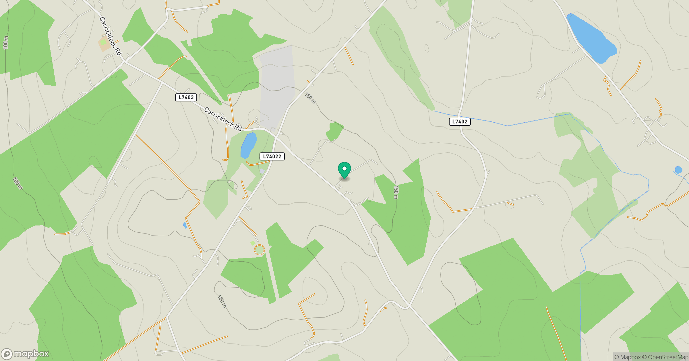
Grid reference: N825917
View on OpenStreetMapOpens a map in a new tab, centred on the hill.
Hills within 30 km
Straight-line distance, not a walking route or confirmation of access.
Mount Oriel [Sliabh Collann]
251m
Slieve na Calliagh [Sliabh na Cailli]
276m
Tievenanass
261m
Aghalion Hill
249m
Taghart South
298m
No comments yet. Be the first.